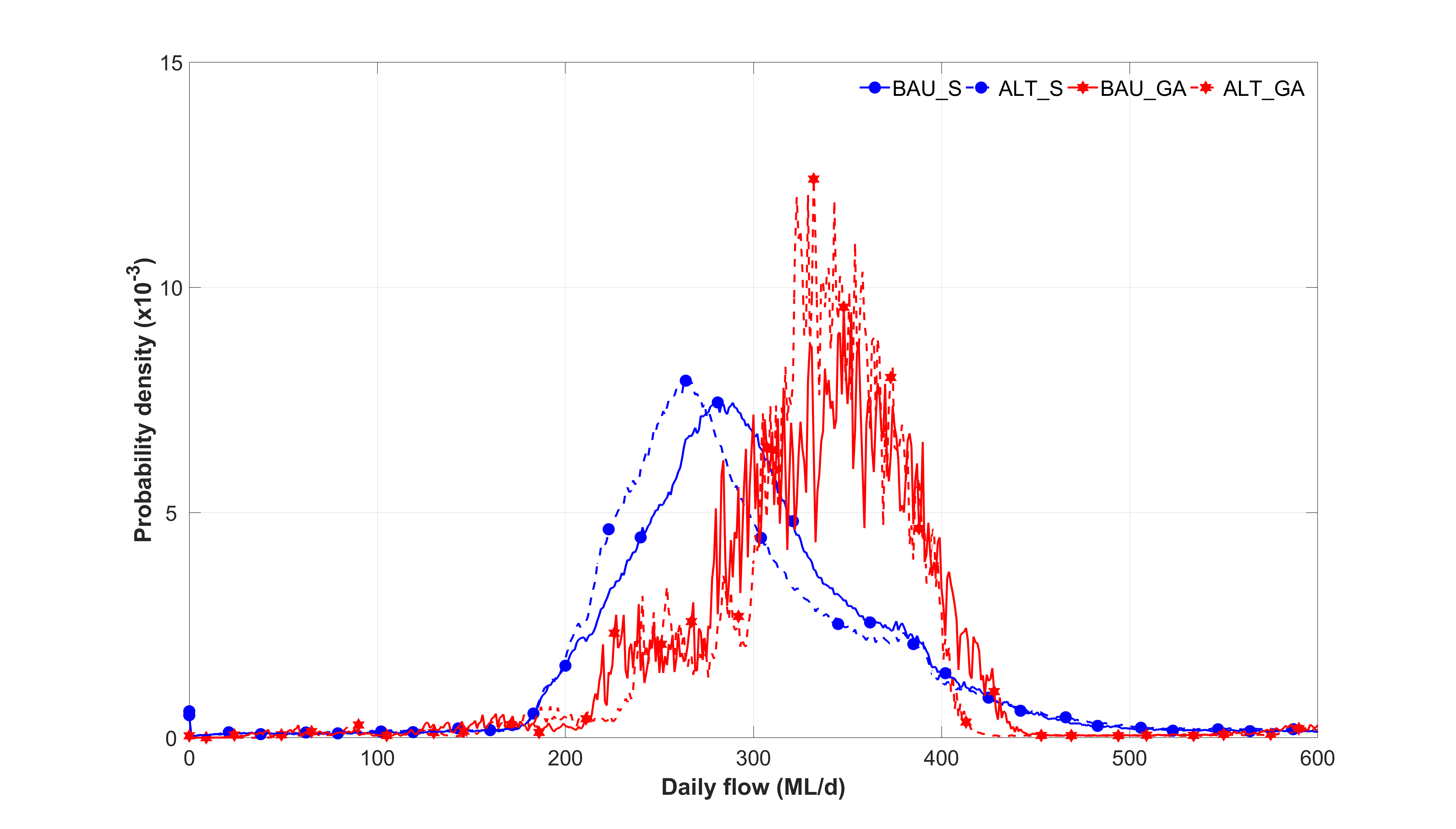
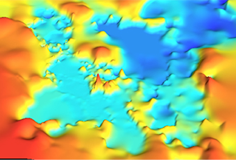
 The water industry is presented with a new era of opportunities that are created by Big Data Analysis of spatial and remotely sensed or obtained information. The collage of images of lakes in the Saudi Arabian desert presented in Figure 1 provides a compelling example of the capability and potential. The digital elevation model was created by combining SPOT satellite images with elevation data obtained from the Shuttle Radar Topography Mission (SRTM) conducted by NASA (National American Space Agency).
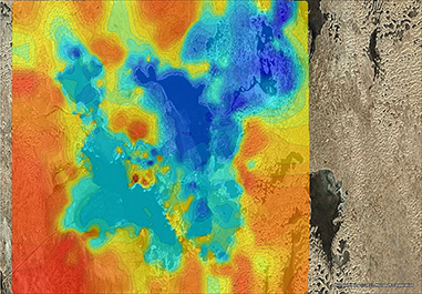
Figure 1: Combining satellite images with data from the space shuttle to create a digital elevation model of lakes in the Saudi Arabian desert
Additional local observations of water depths and global positions from a field survey were used as a “ground truth” for a digital elevation model (DEM) presented in Figure 2.
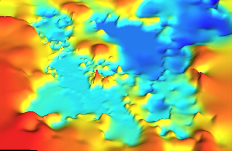
Figure 2: Digital elevation model of the Al Asfar Lake system in Saudi Arabia
Figure 2 revealed the characteristics of the network of perched lakes at Al Asfar and has allowed greater understanding of the behaviour of these important desert waterways. This has led to more informed discussions about management of natural resources in a remote environment. This type of enhanced capability to understand natural resources challenges is highlighted by the spatial map of long term rainfall frequencies for Victoria presented in Figure 3.
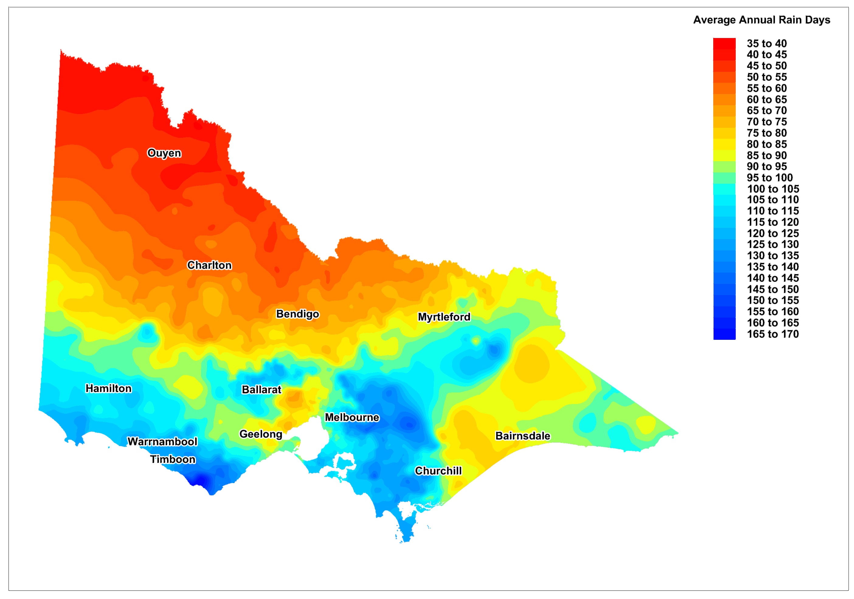
Figure 3: Longitudinal rainfall frequencies throughout Victoria in Australia
The digital model of rainfall frequencies throughout Victoria was derived from raw climate data sourced from the Australian Bureau of Meteorology and processed using Systems Framework for Big Data developed by Urban Water Cycle Solutions. This type of spatial data is being combined with multiple layers of data and information to better understand a range of challenges and opportunities for management of natural resources. In particular, the Office of Living Victoria is utilising these types of modern Systems Framework techniques to frame policies for management of water resources. However, these techniques reveal a wider range of new frontiers of opportunities for many sectors as shown by the map of expected stormwater from urban surfaces throughout Greater Melbourne by 2050 as shown in Figure 4.
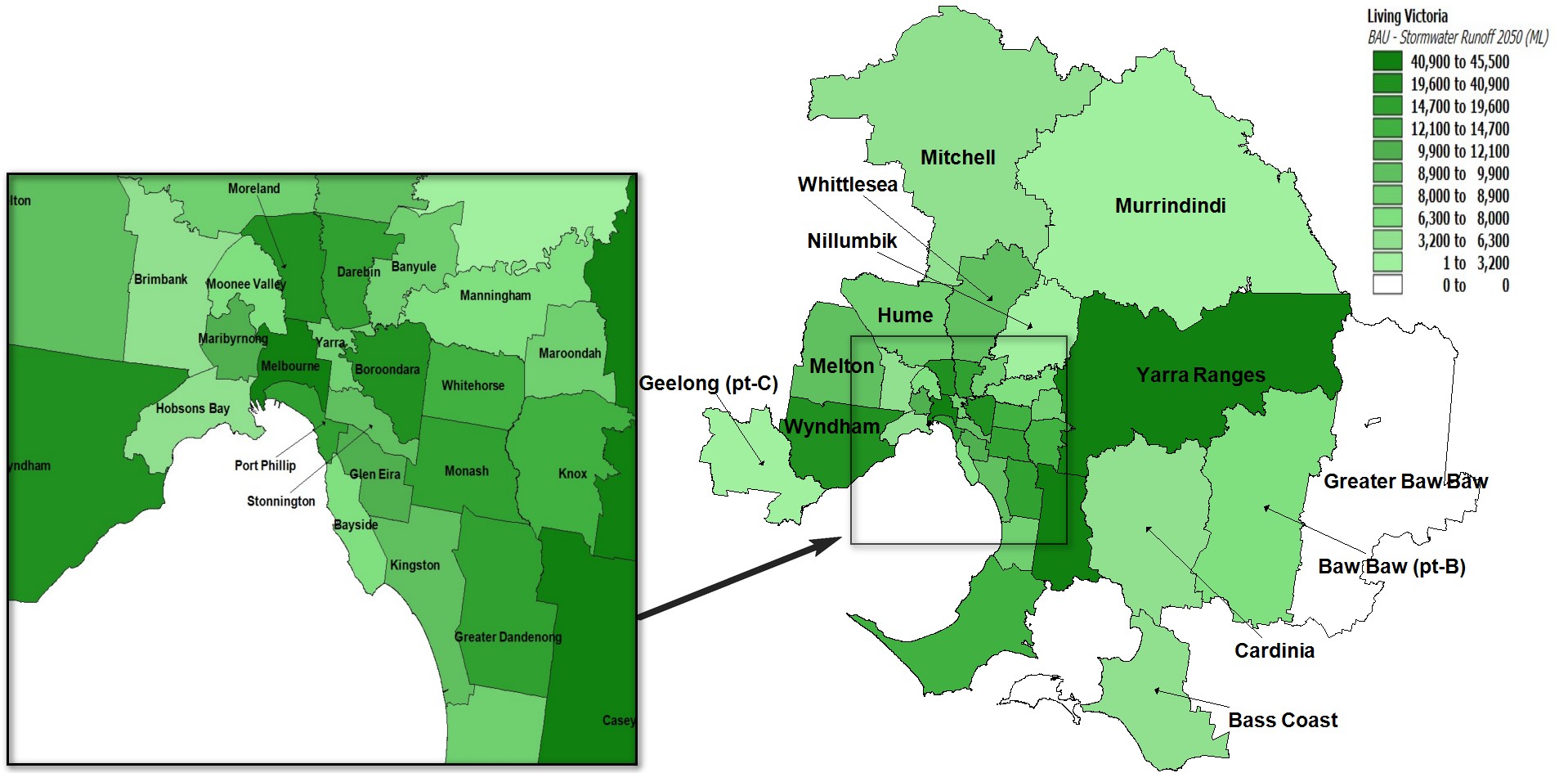
Figure 4: Expected stormwater runoff from urban surfaces throughout Greater Melbourne in 2050
Figure 4 combines multiple layers of information and analysis which highlights the potential provided by Systems Frameworks of Big Data to understand the future challenges and opportunities for the Stormwater Industry. Whilst the cutting edge Big Data analysis techniques may appear to be challenging to implement and understand, they are highly cost-effective which is likely to eliminate many of the former costs and logistic barriers to greater understanding. Additional examples of the potential of Systems Frameworks are provided in www.urbanwatercyclesolutions.com and important spatial information about Australian climate is provided at www.bom.gov.au.
Dr Peter Coombes is the Managing Director of Urban Water Cycle Solutions and the Chief Scientist at the office of Living Victoria. The assistance of Dr Michael Barry and Mark Colegate in developing the images in this article are gratefully acknowledged.