Using surfaces of Big Data to Underpin Continuous Simulation in Systems Analysis
Following our presentation at WSUD 2018 & Hydropolis 2018, our peer reviewed paper can be downloaded below. This publication is part of a set of new research papers that we recently published including Big Data History Reveals Value of Distributed Solutions and Planning for Water Sensitive Communities – the need for bottom up systems analysis.
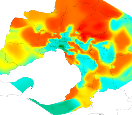
This paper outlines Big Data surfaces the underpin continuous simulation in the systems framework that was designed to explore the multiple scale impacts of water, energy, economic and environmental decisions using a bottom up approach to spatial systems analysis. This approach utilises big data layers of local information to create sub-daily surfaces of climate, stormwater runoff, streamflow, finances and urban water demand. These surfaces of information and a multi-scaled framework of processes permit the generation of multi-site synthetic rainfall and associated continuous simulation of urban processes.
This approach underpins the understanding of the multiple scale systems dynamics of water and energy systems. This paper presents the methodology for simulating multi-site rainfall and water demands based on surfaces of climate, demographic, socioeconomic, topography and environmental information. The approach reproduces observed daily, monthly, annual statistics of rainfall and water use at multiple scales. This demonstrates that the method is able to capture the inter-annual persistence and spatial variability of water use and rainfall that exists within the Greater Melbourne and Sydney regions. The systems method was able to adequately estimate regional water demand including the day to day variation, distributions and strong seasonal patterns. The bottom up construct of the Systems Framework can provide robust evaluation of the regional responses of local interventions such as Water Sensitive Urban Design.
The peer reviewed paper is provided here: Paper


