The sequences of water use, wastewater flows and stormwater runoff from local scale analysis are combined for each zone or sub-catchment using town planning projections and replicates of spatial climate sequences to combine inputs. Zones or sub-catchments are chosen as the intersection of unique zones for town planning, demographics, topography, climate, inflows to waterways and infrastructure, and water supply. This process also combines Local Scale Options to produce future projections of water, wastewater and stormwater runoff for use in the Systems framework. These sequences are then verified and calibrated using hind casting of historical inputs for a period of observed behaviour (see Figure 1).
Figure 1: Schematic of the Systems Framework with a focus on the Transition Scale
A transition framework is used to generate daily water cycle responses for each zone. Sequences of daily water balance results from the local scale simulations were compiled using seasonal information and historical climate data including daily rain depths, cumulative days without rainfall and average daily maximum ambient air temperature to create resource files of water demand, wastewater generation, stormwater runoff, energy use and economic transactions. The method of non-parametric aggregation[1] was then utilised to generate daily water use, wastewater discharges, stormwater runoff, energy use and economic transactions in each zone using the historical resource files and climate replicates generated for the simulation of the regional system. Climate replicates are multiple sequences of equally likely future rainfall and temperature that are generated using Monte Carlo processes (see Figure 2).
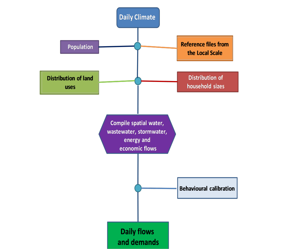
Figure 2: Flowchart of the Transition Framework for combining land use behaviours at the zone scale
Figure 1 demonstrates that at each time step (maximum is daily) climate variables from the regional framework are used to find matching climate variables and coincident daily stocks and flows for each dwelling and land use from the reference files. These results are combined with population, socio-economic and demographic data at each time step to estimate total indoor and outdoor use, sewage flows, stormwater runoff, energy use and economic transactions for each zone. The sequences of data from the local scale simulations are combined in the Transition Framework using the framework presented in Figure 3. Daily sequences of water cycle information; such as water demands, wastewater discharges and stormwater runoff; are combined for different household sizes and land uses, different dwelling types and a combination of different water cycle management Options for each strategy in the Transition Framework.
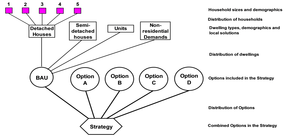 Figure 3: Structure for combining different household sizes, dwelling types and water cycle management Options in the Transition Framework
The climate variables in the regional systems model were derived using the synthetic climate series generated using historical climate sequences. Importantly the climate replicates are temporally and spatially consistent with the rainfall and stream flows in the water supply catchments.
[1] Coombes P.J., G. Kuczera, J.D. Kalma and J.R. Argue (2002). An evaluation of the benefits of source control measures at the regional scale. Urban Water. 4(4). London, UK.